Home
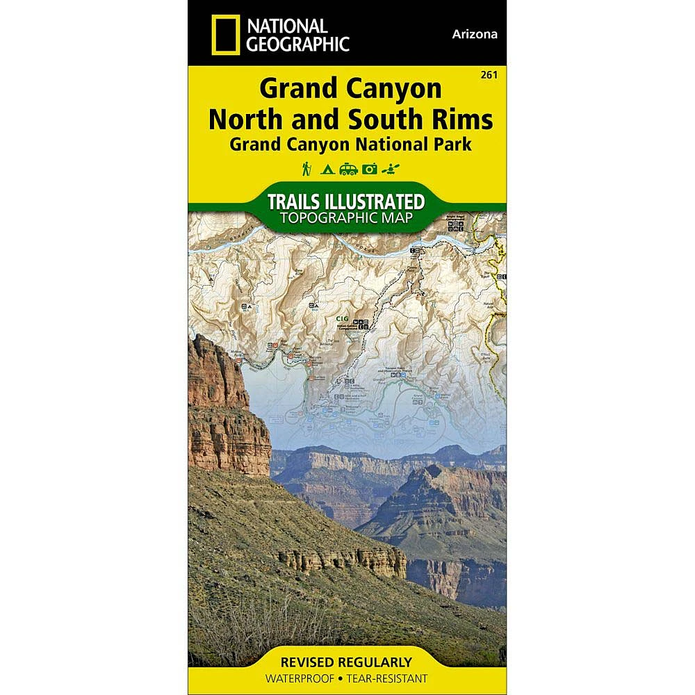
Trails Illustrated Map: Grand Canyon National Park (North and South Rims)
ROCK CREEK
Trails Illustrated Map: Grand Canyon National Park (North and South Rims)
From National Geographic Maps
Current price: $14.95
ROCK CREEK
Trails Illustrated Map: Grand Canyon National Park (North and South Rims)
From National Geographic Maps
Current price: $14.95
Loading Inventory...
Color: Default Title
Size: One Size
Loading Inventory...
The National Geographic Trails Illustrated Map: Grand Canyon National Park (North and South Rims) replaces the previous Grand Canyon National Park Trail Map (#207). Completely redesigned and updated, the map provides an enhanced scale and detail for the highest visitation area of the park surrounding the Grand Canyon South Rim Visitor Center and the Bright Angel Trail.Designed with a wide range of visitors in mind, the map features detailed and easy to read trails, accurate road network, campgrounds, scenic overlooks and points of interests, visitor centers and facilities, color coded bus stops with routes, plus park regulations, backcountry use areas, and contact information for local agencies. This well-balanced mix of detailed cartography and handy resource information makes all Trails Illustrated maps an invaluable resource for both planning and exploring the park. This map features an enhanced scale (1:35,000) for increased detail in this high-use area of Grand Canyon National Park.Coverage highlights: Colorado River miles 60-98, North and South Rim visitor centers, Grand Canyon Village, Grand Canyon / National Geographic IMAX, Tusayan, Grand Canyon Railroad Station, Bright Angel Trail (plus elevation profile), West Rim Trail, Kaibab Trail, Arizona Trail, Grand Canyon Lodge, and more.About Trails Illustrated:More than just a map, National Geographic Trails Illustrated topographic maps are designed to take you into the wilderness and back. Printed on tear-resistant, waterproof material, this map can go anywhere you do. Each map is based on exact reproductions of USGS topographic map information, updated, customized, and enhanced to meet the unique features of each area. The maps include valuable wilderness tips and Leave No Trace guidelines, along with updated trails, trailheads, points of interest, campgrounds, and much more. With a new color palette and stunning shaded relief, backcountry navigation has never been easier.
![Grand Canyon West [Grand Canyon National Park] Map](https://cdn.mall.adeptmind.ai/https%3A%2F%2Fwww.rockcreekoutfitters.com%2Fcdn%2Fshop%2Fproducts%2FGrand-Canyon-West-Grand-Canyon-National-Park-TI00000263_N_20A.jpg_medium.webp)
![Grand Canyon East [Grand Canyon National Park] Map](https://cdn.mall.adeptmind.ai/https%3A%2F%2Fwww.rockcreekoutfitters.com%2Fcdn%2Fshop%2Fproducts%2FGrand-Canyon-East-Grand-Canyon-National-Park-TI00000262_N_20A.jpg_medium.webp)
![Grand Canyon National Park [Map Pack Bundle] Map](https://cdn.mall.adeptmind.ai/https%3A%2F%2Fwww.rockcreekoutfitters.com%2Fcdn%2Fshop%2Fproducts%2FGrand-Canyon-National-Park-Map-Pack-Bundle-TI01020512_N_20A.jpg_medium.webp)